Maps were wrong: scientists found an island that never officially existed.
In the era of high-resolution satellites, it’s hard to believe that an entire island could hide in plain sight, especially when scientists have long been studying what lies beneath the ice of Antarctica. But that’s exactly what happened: the crew of the German icebreaker “Polarstern” accidentally stumbled upon a rocky island in one of the planet’s harshest seas — the Weddell Sea off the coast of Antarctica. The island wasn’t marked on any nautical chart, although it had apparently been there all along — simply disguised as a dirty iceberg.
A Storm in Antarctica Led to the Discovery of an Unknown Island
An international team of 93 scientists and crew members set out on the SWOS (Summer Weddell Sea Outflow Study) expedition on February 8, 2026, aboard the icebreaker of the Alfred Wegener Institute (AWI). The mission was quite specific: to study global ocean currents, the outflow of ice and water from the Larsen Ice Shelf, and the rapid decline of sea ice in the region.
But bad weather changed their plans. A fierce storm in the Southern Ocean forced the team to halt their research and seek shelter near Joinville Island — an icy outpost near the tip of the Antarctic Peninsula. On the navigational chart, there was a vague note: “unexplored navigational hazard” — with no details about what it was or where the information came from.
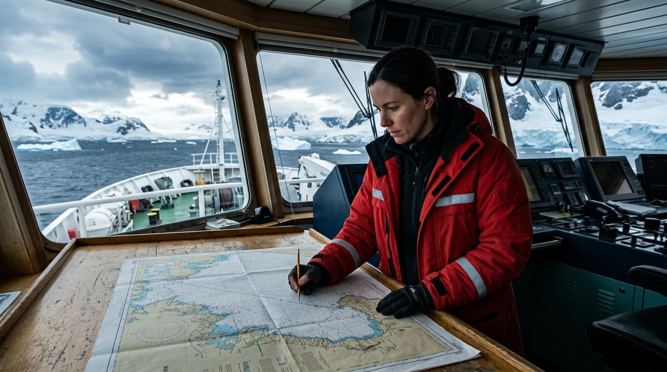
Simon Dreutter, a bathymetry specialist (seafloor cartographer) from AWI, became intrigued by this strange marking. He checked all available coastline data in the lab, found nothing, returned to the bridge — and spotted through the window an “iceberg” that looked suspiciously dirty. Upon closer inspection, it became clear: it wasn’t ice, but rock. The ship changed course — and before the team lay a real island.
Dimensions of the New Island in the Weddell Sea
The scientists didn’t rely solely on visual observations. The navigators carefully guided “Polarstern” toward the object, constantly monitoring the depth — maintaining at least 50 meters under the keel. The icebreaker approached within about 150 meters, circled the island, and scanned the seabed with a multibeam echosounder (a type of high-resolution 3D sonar). A drone was also launched, capturing the island from above — the data was then processed using photogrammetry to create a terrain model and precise coastline map.
The results showed: the island is approximately 130 meters long and 50 meters wide — slightly longer than “Polarstern” itself (118 meters) and roughly twice as wide. The rock rises 16 meters above the water. This was the first systematic survey of this piece of land in history.
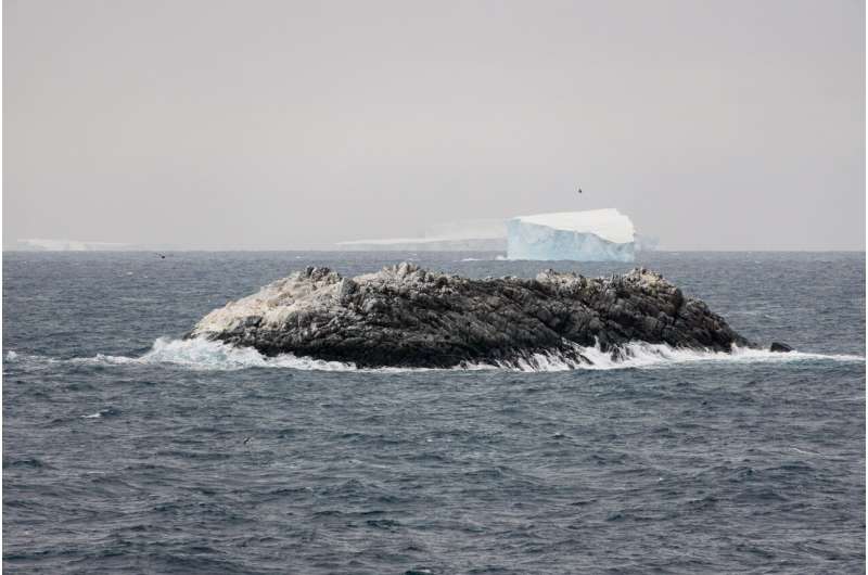
Aerial drone photography of the new island — a rock among drifting icebergs
Remarkably, the island did appear on nautical charts — just not as land, but as an abstract “danger zone.” Moreover, its marked position differed from its actual location by about one nautical mile (approximately 1.85 km). On satellite images, the island is virtually indistinguishable from the dozens of drifting icebergs around it — due to its ice cover, it blended completely with its surroundings.
Melting Ice in Antarctica Reveals Hidden Land
The main question: where did the island come from? Had it always been there, simply hidden under ice and snow, or did it emerge from beneath a retreating glacier only recently? There’s no definitive answer yet, but researchers believe that climate changes in the region played a key role in its discovery.
For a long time, Antarctic sea ice was considered relatively stable — unlike the Arctic, where summer ice area had been shrinking by approximately 12% per decade since satellite observations began in 1979. However, starting around 2017, the summer sea ice area in the northwestern Weddell Sea began to decrease sharply — presumably due to warming surface waters. And this is part of a broader problem, because sea ice around Antarctica protects ice shelves from warm water.
The expedition recorded unexpectedly intense surface melting that affected the snow cover and upper ice layers. According to expedition leader Professor Christian Haas, the ice was often nearly devoid of snow and had a bluish or grayish surface — conditions more typical of the Arctic than the Antarctic. Beneath the ice cover, instruments detected significant volumes of fresh meltwater.
This widespread melting means that other land areas may yet be discovered in Antarctica, still hidden beneath the ice. Each such object is a potential natural laboratory for studying how climate is literally exposing the planet’s surface.
When the Discovered Island Will Appear on Nautical Charts
The island doesn’t have an official name yet. The process of naming a new geographical feature is slow and bureaucratic. An international committee will review the discovery, and this could take several months.
By maritime tradition, the discoverers have the right to propose a name. Boris Dorschel-Herr, head of the AWI bathymetry group and expedition participant, already has such experience: in 2014, he and his team succeeded in getting two seamounts in the South Atlantic and Weddell Sea added to charts.
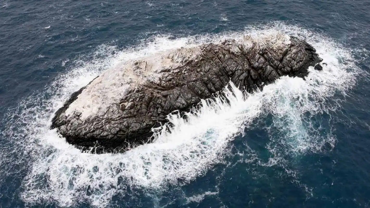
View of the newly discovered and still unnamed island in the Weddell Sea.
Exact coordinates will be published after the naming procedure is complete. The data will be entered into the International Bathymetric Chart of the Southern Ocean (IBCSO) — the key database for seabed relief in this region. This is critically important: due to the small number of measurements and the need for interpolation, data processing algorithms simply “erase” unconfirmed objects. Now the island is securely established in digital space.
Why the Island Discovery Changes Our Understanding of Antarctica
This story is not just a curiosity from the “funny things happen” category. It highlights several serious issues at once.
First, our maps of Antarctica are far less accurate than they seem. Vast areas of the Southern Ocean still rely on old data and estimated calculations rather than direct measurements. Even satellites are powerless when a rock is covered in ice and surrounded by dozens of similar-looking icebergs.
Second, the discovery underscores the pace of change in the Antarctic. What was reliably hidden under ice for decades is now being exposed — and scientists are gaining access to territories that were previously physically unreachable.
Finally, such discoveries create new research opportunities. Each newly found piece of land is an untouched ecosystem, a geological sample, and a reference point for observing climate processes.
The SWOS expedition concluded on April 9, 2026, in the Falkland Islands. “Polarstern” has already headed across the Atlantic to its home port of Bremerhaven, where it is expected to arrive in mid-May. Ahead lies the analysis of collected data, which will reveal what contribution organisms living in and under the ice make to the carbon cycle of the Southern Ocean. And the unnamed island in the Weddell Sea simply waits — it’s used to that.