Gravity on Earth is not uniform. But there are several places on Earth where it differs especially strongly from the norm. Image source: scmp.com
Drop a ball in Moscow, then fly to Peru and drop the same ball there — and it will fall just a tiny bit slower. The difference is not large, but it is real and measurable. Gravity on Earth’s surface is not uniform, and over recent decades scientists have compiled a detailed map of these variations. It turns out that our planet has places with real gravitational “dips” — and the explanations for them are completely different.
Why Gravity on Earth Differs in Different Places
We are used to thinking of gravity as something constant. Toss your keys — they fall. Everywhere and always the same. But the force of attraction depends on two things: mass and distance from it. The closer you are to a large amount of heavy material, the stronger it pulls you.
The principle is the same as with the Moon and Jupiter. Jupiter is 26,000 times more massive than the Moon, but lunar gravity affects the Earth much more strongly — simply because the Moon is much closer. In the same way, on Earth itself: if in some place beneath you there is a “deficit” of dense rock, or you are farther from the center of the planet, the force of gravity will be slightly weaker.
Additionally, the Earth is not a perfect sphere. Due to its rotation, it is slightly flattened at the poles and bulges at the equator. This means that at the North Pole you are closer to the main mass of the planet than at the equator, and you weigh slightly more there. But this is just one factor among several.
How NASA Satellites Mapped Earth’s Gravity
To understand exactly where gravity is stronger or weaker, very precise equipment is needed. Ground-based instruments — spring gravimeters — can detect the slightest fluctuations in gravitational force. But the real breakthrough came with the launch of the NASA GRACE (Gravity Recovery and Climate Experiment) mission.
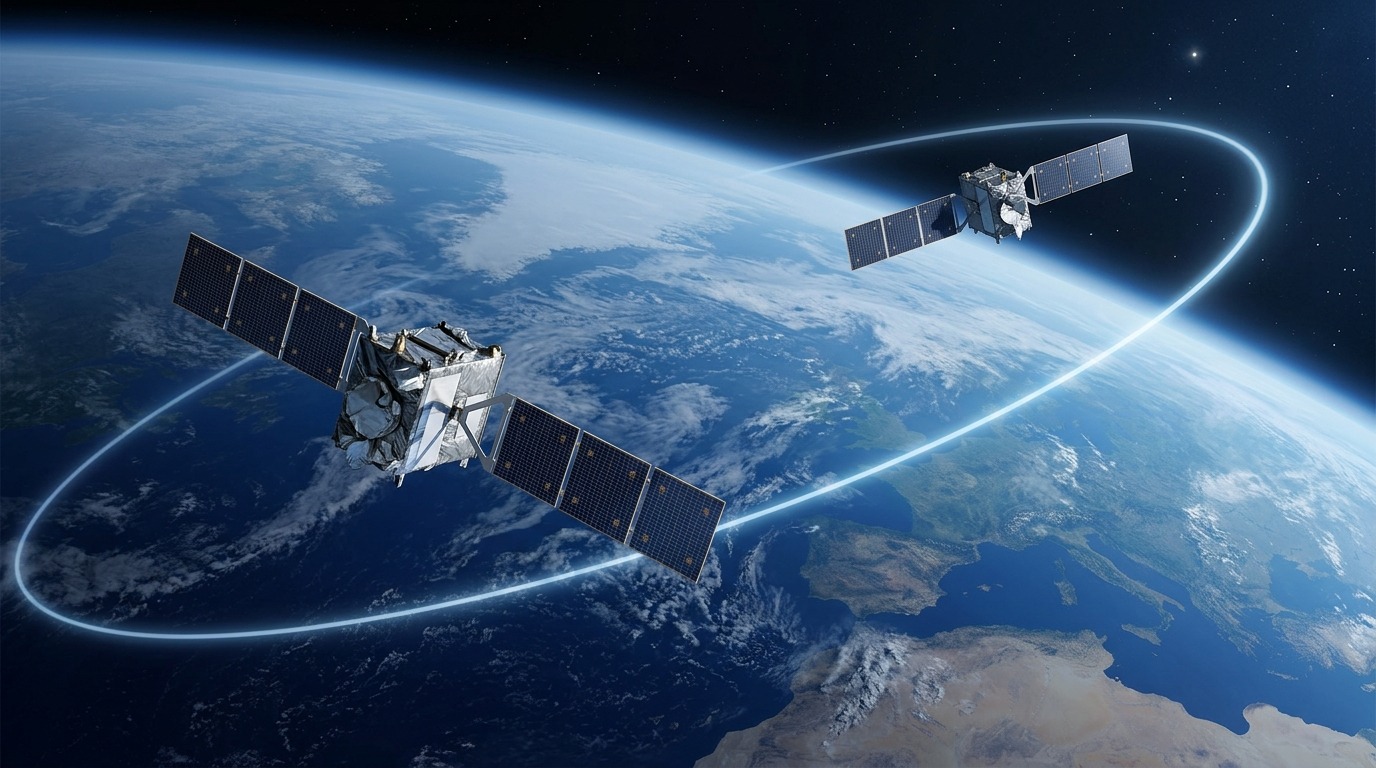
Two satellites of the GRACE mission measured gravity by tracking the distance between themselves
The idea was elegant: two satellites flew in the same orbit 220 kilometers apart. When the leading satellite passed over a zone with increased gravity, it accelerated slightly and the distance between the spacecraft increased. When gravity was weaker — the opposite happened.
From these tiny changes in distance, scientists built a detailed gravitational map of Earth, on which “anomalies” are clearly visible — places where the force of gravity noticeably differs from the calculated value. It was this map that revealed several surprising points on the planet.
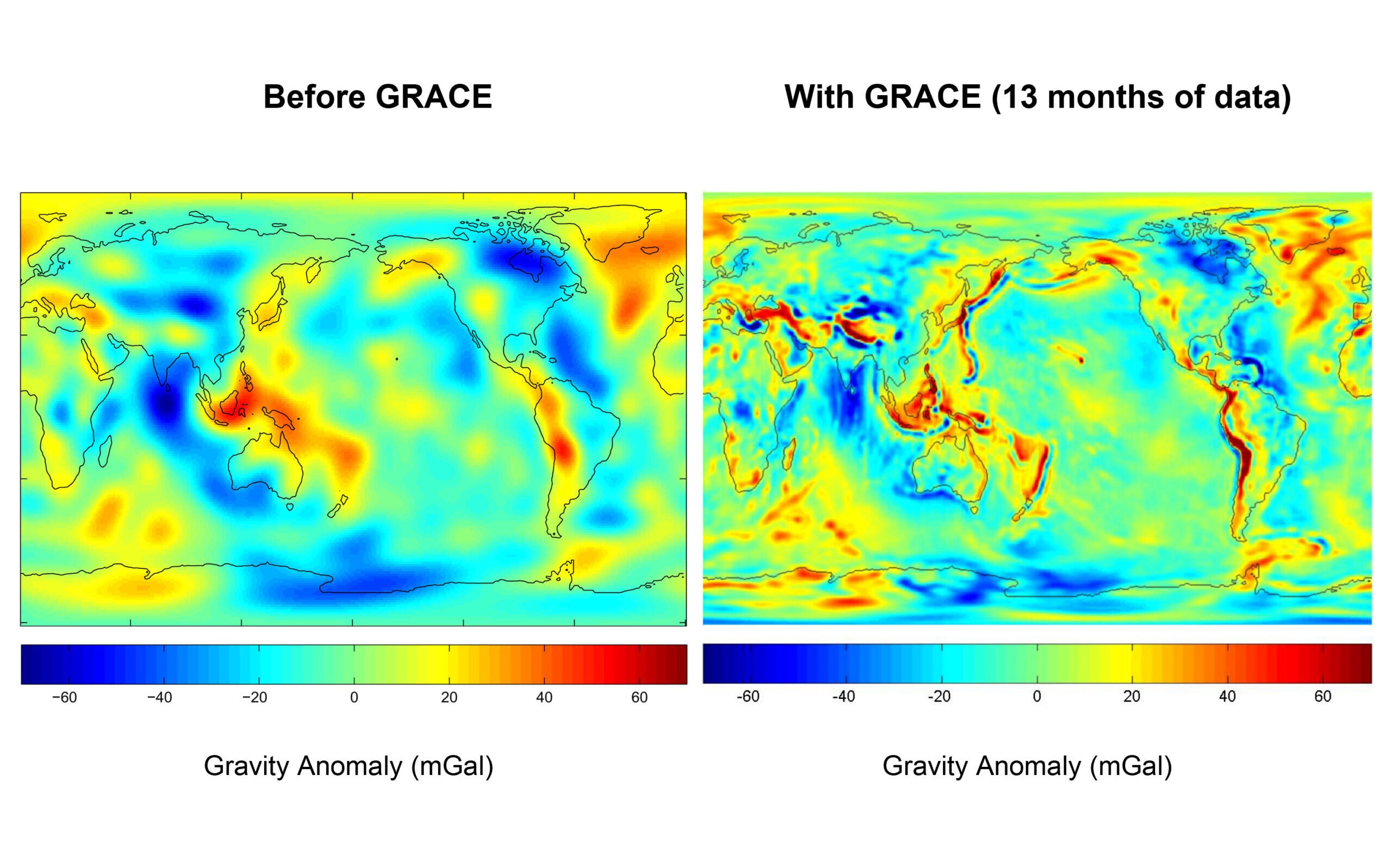
Gravitational map of Earth. Image source: jpl.nasa.gov
Hudson Bay — A Zone of Weak Gravity on Earth
One of the most well-known gravitational anomalies is located in the Hudson Bay area in northern Canada. Here, the force of gravity is approximately four thousandths of a percent lower than the planetary average. It sounds like a negligible figure, but for geophysicists it is an enormous difference that required a serious explanation.
The reason is connected to the last ice age. The gigantic Laurentide Ice Sheet, which covered most of Canada, was so heavy that it pressed down the Earth’s crust and displaced dense rocks from beneath it. When the ice melted, the “dent” remained — the area is still slowly rising, recovering its lost mass.

Hudson Bay — one of the places where gravity is noticeably weaker due to the consequences of the ice age. Image source: travel.rambler.ru
But this explains only 25–45 percent of the anomaly. The rest, according to GRACE mission data, is related to processes deep beneath the surface. Convection currents of magma in the mantle pull continental plates downward, reducing the density of material in the region. The result is a double effect: from above — the aftermath of the glacier, from below — the movement of molten rock.
Puerto Rico Trench — The Largest Gravitational Anomaly
While Hudson Bay is famous, the true record holder for gravitational deviation from the expected value is the Puerto Rico Trench in the Atlantic Ocean. It is the deepest point of the Atlantic, and it is here that the largest negative gravitational anomaly on Earth has been recorded — about 380 milliGals below the calculated value.
Geophysicist Peter Molnar helped explain the cause back in 1977. Previous models assumed that the thickness of the Earth’s crust was more or less the same everywhere. Molnar showed that this was not the case: beneath the trench hangs a massive and dense “flap” of Atlantic lithosphere — essentially a huge piece of rock slab bent downward. It redistributes mass in such a way that gravity above the trench turns out to be noticeably weaker than one would expect.
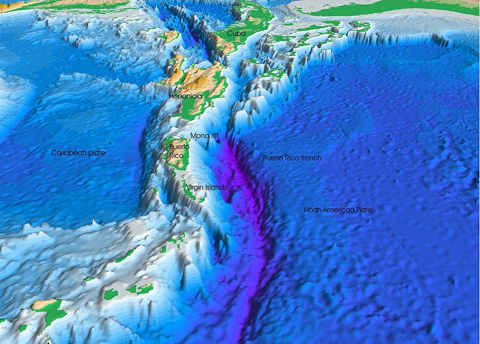
Puerto Rico Trench. Image source: ru.wikipedia.org
It is important to clarify: this is not about the weakest gravity in an absolute sense, but about the largest deviation from the calculated value. These are different things — and for scientists, the anomaly is more interesting than the absolute figure.
Where on Earth Is Gravity the Weakest in the World
But if the question is different — where on the planet’s surface is the acceleration due to gravity at its minimum in absolute figures — the answer may surprise you. The logical candidate is the summit of Everest: the higher you are from the center of the Earth, the weaker the attraction. But the record here doesn’t belong to it either.
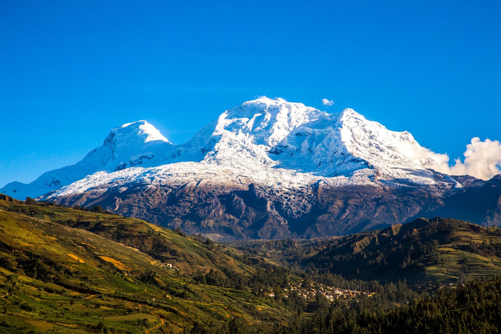
The weakest gravity on Earth’s surface has been recorded on Mount Nevado Huascarán in the Peruvian Andes. The acceleration due to gravity there is 9.7639 m/s² — noticeably less than the standard 9.81 m/s².