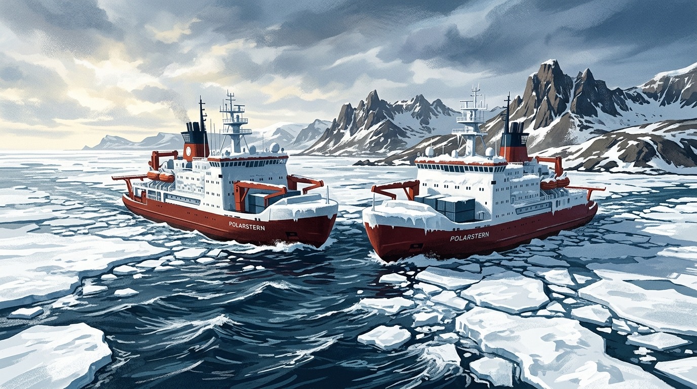
Icebreaker Polarstern in Antarctic waters
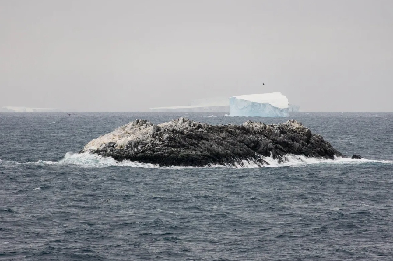
An international expedition in the Weddell Sea stumbled upon a “dirty iceberg” that turned out to be a real rocky island unknown to science. The island, 130 meters long, has still not been plotted on any nautical navigation chart. It would seem that in the era of satellites and drones there are no more blank spots on maps, but Antarctica proves otherwise.
Scientists discovered an unknown island in Antarctica
Since February 8, 2026, the German research icebreaker Polarstern had been working in the northwestern part of the Weddell Sea. On board were 93 scientists from different countries studying the outflow of water and ice from the Larsen Ice Shelf and the dramatic decline of sea ice in the region. Due to stormy weather, the crew was forced to interrupt their work and take shelter behind Joinville Island. It was on this route that the scientists noticed something strange. This was reported by the authors of the IFL Science website.
On our route, the nautical chart showed a zone with unexplored navigational hazards, but it was unclear what it was and where this information came from, — said Simon Dreutter, a bathymetry (seafloor mapping) specialist from the Alfred Wegener Institute.
Dreutter decided to carefully examine all the coastlines in the laboratory, then went to the bridge and saw through the window an “iceberg” that looked “somewhat dirty.” Upon closer inspection, it became obvious that it was not ice but rock. The ship changed course and headed toward the discovery.
Why the island is indistinguishable from an iceberg
The Polarstern circled the island. Scientists used drones and echo sounders to measure it and map the surrounding seabed. The result: the island is approximately 130 meters long, 50 meters wide, and its maximum height above water is 16 meters. For comparison, that’s roughly like a five-story building standing in the middle of an icy ocean.
Even at a distance of 150 meters from the island, the sea depth was at least 50 meters, meaning the island rises sharply from the bottom like a solitary rock. Satellite images explain why it wasn’t discovered earlier: from space, it is indistinguishable from the surrounding icebergs. Some navigation charts contained a mark in this area, but it was offset by 1.82 kilometers from the island’s actual position and was simply labeled as a “danger zone.”
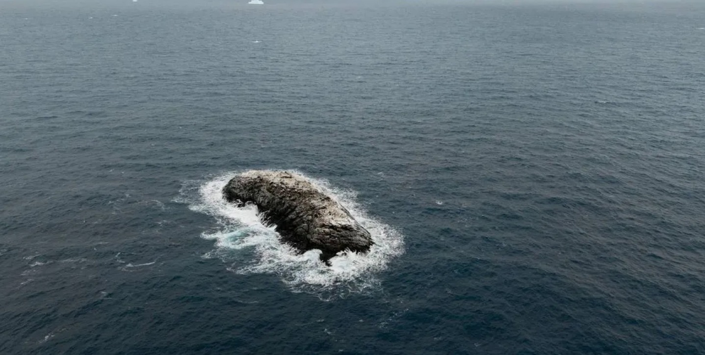
Aerial view of the new island — among the ice it is nearly indistinguishable from an iceberg. Image source: IFL Science
Why we haven’t discovered all the islands yet
It may seem surprising that in 2026 we are still finding islands that aren’t on any maps. But for Antarctica, this is quite understandable. The Weddell Sea is one of the most inaccessible places on the planet. Even in summer, much of it is covered with ice, and weather conditions are so harsh that only powerful icebreakers like the Polarstern can reach it.
The main bathymetric chart of the region covers the territory south of 50 degrees south latitude. At the same time, according to the project’s data, less than 24% of the seabed in this zone is covered by actual measurements. The rest is interpolation — mathematical “guessing” of the terrain between measurement points. Under such conditions, small objects like a little rocky island simply get “erased” from the map.
It is precisely due to the lack of data and reliance on interpolation that "such uncharted objects simply disappear" from bathymetric charts.
The new island has not yet been named
The team now faces the task of giving the island an official name. Until the naming procedure is complete, the exact coordinates will not be published. After that, the island will be added to international navigation charts and important scientific databases.
For navigation, this is truly important because a rock protruding from the water in a zone marked simply as “dangerous” poses a real threat to ships. Precise coordinates and depths around the island will make this stretch of sea safer. Additionally, data on the underwater terrain helps scientists better understand the geology and ecosystem of the Weddell Sea — a region that plays a key role in global ocean circulation.
One of the experts on board, Boris Dorschel-Her, head of the bathymetry group, already has experience with such discoveries. In 2014, he and his team discovered two underwater mountains — one in the South Atlantic, another in the Weddell Sea — and successfully had them added to navigation charts.
Up close, the island doesn’t look much like an iceberg, but from space… Image source: IFL Science
What scientists learned about Antarctic ice melting
The island was an unexpected bonus of the expedition. The scientists’ main goal was to understand why Antarctic sea ice has been shrinking so dramatically in recent years. For a long time, it was believed that Antarctic ice was relatively stable, unlike Arctic ice, whose area is shrinking by approximately 12% per decade. However, starting in 2017, rapid summer ice melting has been observed in the northwestern part of the Weddell Sea, presumably due to warming surface waters.
Expedition leader Professor Christian Haas noted that ice thickness varied significantly: on the western continental shelf, the ice reached four meters, while farther east, closer to the Ronne and Filchner ice shelves, it was about one and a half meters. At the same time, surface melting was so intense that conditions began to resemble those of the Arctic, with nearly complete disappearance of snow cover and a characteristic bluish-gray color of the ice.
The expedition concludes on April 9, 2026, in the Falkland Islands, after which the Polarstern will head across the Atlantic to its home port of Bremerhaven.
The small unnamed island in the Weddell Sea is an excellent reminder of how little we still know about the most remote corners of our own planet. Even with orbital satellites, underwater drones, and digital maps, the Earth is capable of delivering a surprise that is only discovered when a person looks out a ship’s window and says: “That iceberg looks kind of strange.”